X

GIVING DAYS 2024
Double your impact
by making a gift during
Giving Days May 7 & 8
Double your impact
by making a gift during
Giving Days May 7 & 8


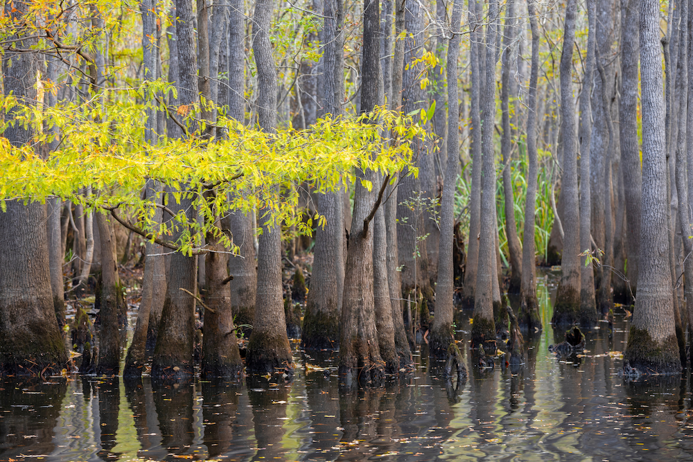
South Carolina's wetlands are disappearing.
Federal rollbacks, state inaction and the fastest growth rate in the nation are converging at exactly the wrong time. In 2022, SCELP developed a free, practical tool to help local governments meet this moment: a model wetlands ordinance that any county or municipality can adapt and adopt to protect wetlands and their community.
Access the Model OrdinanceSouth Carolina is home to a variety of wetlands shaped by its coastal plain, rivers and climate – from salt, brackish and freshwater marshes along the coast to inland swamps, bottomland hardwood forests and Carolina Bays. Wetlands make up approximately 23% of the state's total land area, and half of the salt marsh on the entire Eastern Seaboard of the United States.
Wetlands are areas of land saturated with water at or near the soil surface for extended periods of time. They are defined by three core characteristics: hydrology, soil typology and water-loving vegetation.
South Carolina has already lost an estimated 27% of its historic wetlands – more than 2.3 million acres – and the pace of loss is accelerating as population growth and development pressures increase across the state.
For decades, the federal Clean Water Act provided a national framework for wetland protection, but that framework has been steadily narrowed by the courts. Beginning with SWANCC in 2001 and continuing through Rapanos in 2006 and years of battles over the Waters of the United States rule, federal protections for wetlands have been methodically chipped away. In 2023, the U.S. Supreme Court's 5-4 decision in Sackett v. EPA stripped protections from millions of acres of wetlands across the country overnight, the most sweeping rollback yet.
The NRDC estimates that under the most damaging interpretation of Sackett, more than 1.77 million acres of South Carolina's wetlands – roughly three-quarters of the previously regulated total – are vulnerable to losing federal protection.
South Carolina currently has no independent state permitting authority over freshwater wetlands. SCELP continues to advocate for a state wetlands bill, but for now, what the federal government no longer protects, nothing else does – unless local governments act.
When wetlands are filled and built upon, they lose their ability to absorb floodwaters, lower storm surge, slow downstream water movement and filter pollutants from the environment. The result for surrounding communities is a compounding cycle of increased flooding, degraded water quality and accelerating erosion – a destructive combination that only worsens as intense storm events become more frequent.
The communities most at risk are already feeling the pressure:

Wetlands are not just scenic landscapes; they are living, working natural infrastructure. Losing them has direct, measurable consequences for communities across South Carolina, including:
Flood Control & Flood Insurance Discounts Wetlands absorb and slowly release water during rain and storm events, providing a critical – and irreplaceable – buffer between communities and flood damage. The EPA estimates that a single acre of wetland can hold up to 1.5 million gallons of floodwater.
The numbers tell a story of what happens when that buffer disappears. In thirty years, flood insurance claims in South Carolina have increased more than tenfold – from $45 million between 1995 and 2005, to $165 million between 2005 and 2015, to nearly $600 million between 2015 and 2025. Protecting wetlands is one of the most cost-effective tools communities have to reverse that trend.There is also a direct financial incentive for local governments to act: communities that adopt stronger floodplain management standards – including wetlands ordinances – may improve their NFIP Community Rating System score, qualifying their residents for discounts on flood insurance premiums.
Water Quality Wetlands naturally filter pollutants, remove excess nutrients and slow water flows, allowing sediment to settle before it reaches local waterways. When wetlands are filled for development, that filtration disappears, and pollution runs directly downstream. They also recharge groundwater supplies that communities depend on for drinking water.
Storm Protection Coastal wetlands reduce the damaging effects of hurricanes and major storm events by absorbing energy. A 2021 study found that coastal wetlands save more than 4,600 lives annually worldwide and provide an estimated $447 billion in storm protection.
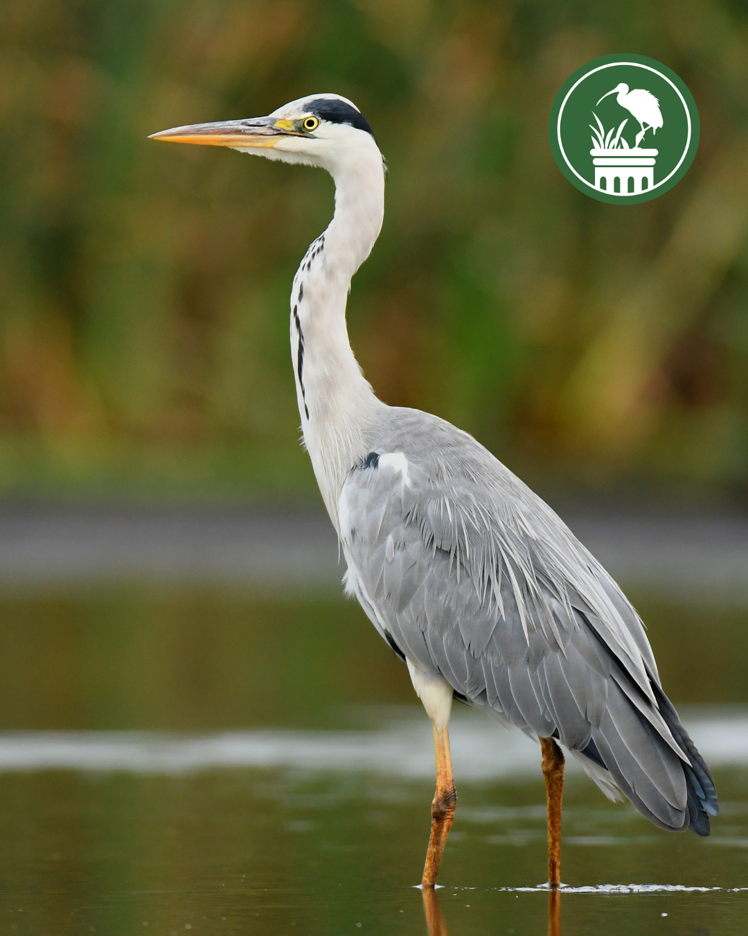
Wildlife Habitat Wetlands are among the most biologically diverse ecosystems on the planet, comparable to tropical rainforests and coral reefs. They provide critical habitat for birds, fish, amphibians, reptiles and numerous rare, threatened and endangered species. Coastal wetlands also support South Carolina's fishing industry by providing essential nursery grounds for shrimp, fish and crabs.
Additional Benefits Wetlands also sequester carbon by storing organic matter in waterlogged soils and support recreation, tourism and outdoor industries – from fishing and hunting to birdwatching and kayaking – all of which are woven into South Carolina's economy and way of life.
When federal and state protections fall short, local governments have the authority – and the responsibility – to fill the gap.
A local wetlands ordinance can require permits for any activity that would disturb or fill wetlands that are no longer within the Clean Water Act’s federal jurisdiction, establish vegetated buffers that protect wetland function and water quality and provide a clear, enforceable framework for responsible development.
The science is clear: buffers of at least 50 to 100 feet are needed to protect wetland systems effectively. Buffers of 30 feet or less provide little protection, and while the first 15 to 30 feet remove some pollutants, consistent filtration requires more. The right buffer size depends on the wetlands' functional value, the sensitivity of the surrounding landscape – including proximity to wildlife refuges, parks,and other protected areas – the intensity of adjacent land use and the specific functions the buffer needs to provide.
SCELP has developed a model wetlands ordinance designed specifically for South Carolina municipalities and counties. It is built to minimize implementation costs, streamline the process alongside existing state and federal requirements and provide flexible, locally tailored protections for the wetlands in your community.
Ready to protect your community's wetlands? Access our model ordinance and start a conversation with our team about how to make it work for your jurisdiction.
SCELP has advocated for stronger wetland protections in South Carolina for decades – at the state level, in the courts and, increasingly, in partnership with local governments across the coast and beyond.
In 2022 – anticipating the Sackett v. EPA decision that would come in 2023 – we developed the model wetlands ordinance for counties and localities across South Carolina, giving local governments the tools to protect wetlands within their own jurisdictions, regardless of what happens at the federal or state level.
That work is already making a difference →
The Town of Bluffton became the first municipality in South Carolina to pass a wetlands protection ordinance in response to Sackett v. EPA, requiring a 50-foot undisturbed buffer around on-site wetlands. Bluffton is now strengthening its ordinance further with a comprehensive wetlands mapping tool. Bluffton's ordinance is also drawing national attention. In May 2026, SCELP Staff Attorney Emily Poole presented at an Environmental Law Institute webinar on the role local governments can play in protecting wetlands, highlighting Bluffton's ordinance as a model for communities across the country.
The Town of Awendaw has also passed a standalone wetlands ordinance based on SCELP's model.
Georgetown County passed its version of the ordinance in June 2026 – a major milestone for one of the state's most wetland-rich and vulnerable coastal counties.
Whether you are a local official looking to take action or a resident who wants to see your community better protected, there is a role for you in this work.
For local governments: Access our model wetlands ordinance and connect with our team. We will work with you to adapt it to your jurisdiction, answer legal questions and support you through the process at no cost.
For residents and advocates: The most powerful thing you can do is make your voice heard with local decision-makers. Ask your county council or town government whether they have considered a wetlands ordinance. Share what's at stake. And stay connected with SCELP for updates on this issue as it develops across the state.
Questions?
Lowcountry: Jessie White, Senior Attorney & Kenzie Poole, Staff Attorney
Midlands & Upstate: Emily Poole, Staff Attorney
PeeDee: Monica Whalen, Staff Attorney